Commissioning new seabed mapping technology on the RV Corystes
Date published:
Following the installation and commissioning of the new EM2040 multibeam echosounder (MBES), Kongsberg Discovery announced a multibeam image competition.
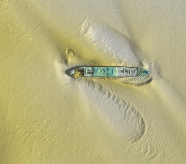
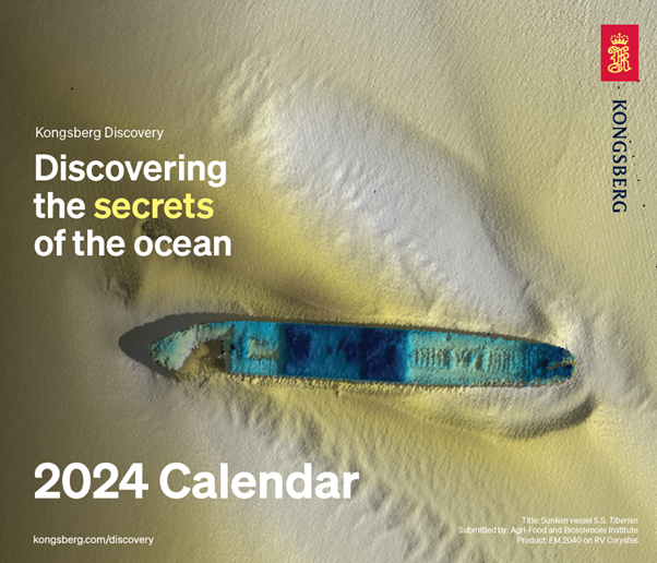
The Kongsberg engineer that fitted AFBI’s MBES, César Carro Ribes, asked if he could use the patch test data to practise processing and enter the results into the competition. The submission that César made to the competition was awarded top winner of the three winning images. The prize was for Kongsberg Discovery to donate $1,000 to one of their approved charities (we have yet to make this choice) and the image is included in a calendar that Kongsberg release monthly via LinkedIn which anyone can download.
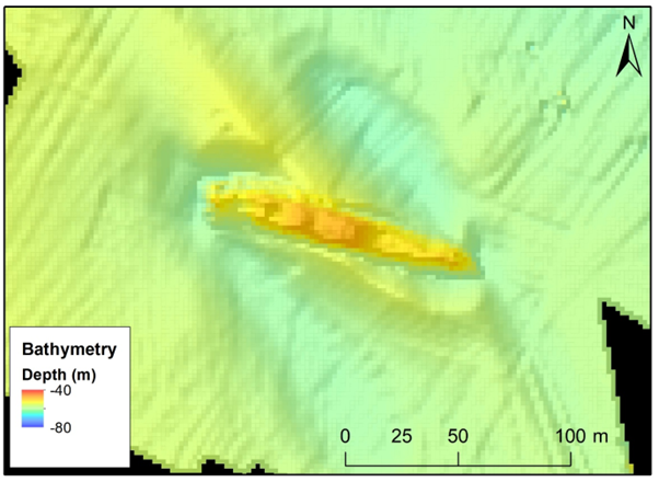
The wreck has been surveyed a few times and the images below show the difference between the capabilities of the old MBES (EM3002) that we have replaced with an EM2040. The EM3002 image is from 2008, gridded at 2 m and the winning image is gridded at 50 cm. Whilst the same overall feature morphology is revealed, the new system enables much finer detail to be revealed.
This increase in sounding density combined with modified sound emitting techniques means that the Seabed Mapping project should be able to create more detailed maps with more accurate characterisation of seabed substrata in the provision of advice to DAERA and other customers.
This improved survey capability also bolsters AFBI’s membership of the UK Centre for Seabed Mapping and ensures that data collected are complementary to external projects such as DAERA’s coastal mapping programme that is making use of LiDAR technologies.